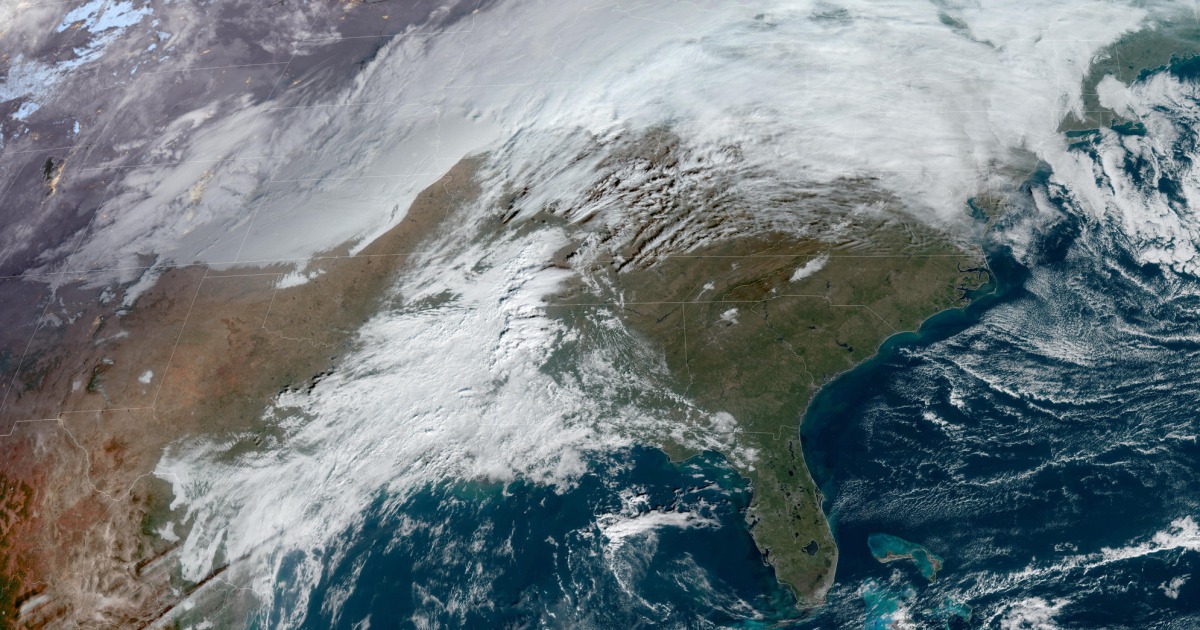
A cross-country winter storm system is expected to bring severe weather conditions to the South and Northeast.
About 16 million people are at risk of a bout of severe weather Tuesday in the Mississippi and Tennessee river valleys, which will include parts of Alabama, Arizona, Louisiana, Mississippi and Tennessee.
Strong, long-track tornadoes will be possible along with hail the size of a baseball or larger and potentially destructive winds of 75 mph.
Jackson, Mississippi, is in the center of the severe weather risk area, and other cities to watch include Memphis, Tennessee; New Orleans; Birmingham, Alabama; and Shreveport, Louisiana.
Since sunsets are before 5 PM in most of the risk area, most dangerous storms will occur in the dark. This will compound the danger, as nighttime tornadoes are 2.5 times more likely to be fatal than daytime tornadoes.
Flood watches are also in effect along parts of the east-central Gulf Coast where storms could cause flash flooding through Wednesday morning.
The storm system will move east on Wednesday, bringing strong thunderstorms, heavy rain and wind to the East Coast. Rain and wind will be the main weather drivers for the Mid-Atlantic area to New England, with strong storms possible from Georgia to northern Florida.
Atlanta; Mobile, Alabama; New Orleans; and Tallahassee, Florida could see strong thunderstorms, especially in the first half of the day.
It is likely to rain in New York City for the tree lighting at Rockefeller Center on Wednesday. There will also be wind gusts near 40 mph in the city, with temperatures forecast to be in the low 50s.
More than 1,170 flights traveling to or from US airports were delayed and 191 flights canceled as of 11:45 a.m. ET Tuesday, according to FlightAware.com. The majority of those cancellations, 120, were at Seattle-Tacoma International Airport, where Alaska Airlines canceled 79 flights due to winter weather expected in the area.
“Our flight operations will be affected on Tuesday and throughout the week,” the airline said in a statement. “Additional cancellations are possible as we assess the impact of weather on our operation.”
The north side of this cross country storm system will bring snow, which will affect the Upper Midwest.
As of Tuesday morning, snow was moving across parts of the central Rocky Mountains and northern Great Plains, into the Upper Midwest, including parts of Iowa and Minnesota.
This area of snow is expected to continue east and move to places like Minneapolis-St. Paul metropolitan area Tuesday afternoons and early evenings. Some snowfall rates of 1-2 inches per hour could sometimes arrive around the evening peak time.
A total of 3 to 6 inches of snow is likely from southern Minnesota to western Michigan’s Upper Peninsula through Wednesday.


